
Seeking sunburn relief, Jordi asked me last night if I had any aloe vera lotion. I rummaged through my collection of potions in sample-sized packets. Among the niacinamides, ceramides, retinol, and moon-powered creams, I expected to find something for sunburn. Nothing.
We both went to bed, and I meta-dreamt that Jordi asked me for aloe vera lotion. I still couldn’t generate a bottle of lotion in my dream, but I had the plant.

I also have the plant in reality.
I woke up around midnight, turned on the night light and shared my realization with Jordi, “I have an aloe plant!”
“I know.”
“Why didn’t you say something?”
“Because it’s your plant.”
If only my dreams could reliably serve solutions to real-life problems. I also dreamt that I peered through the window of my old unit to find cars parked in the living room. “That bitch! She evicted us to make money off storing people’s cars!”
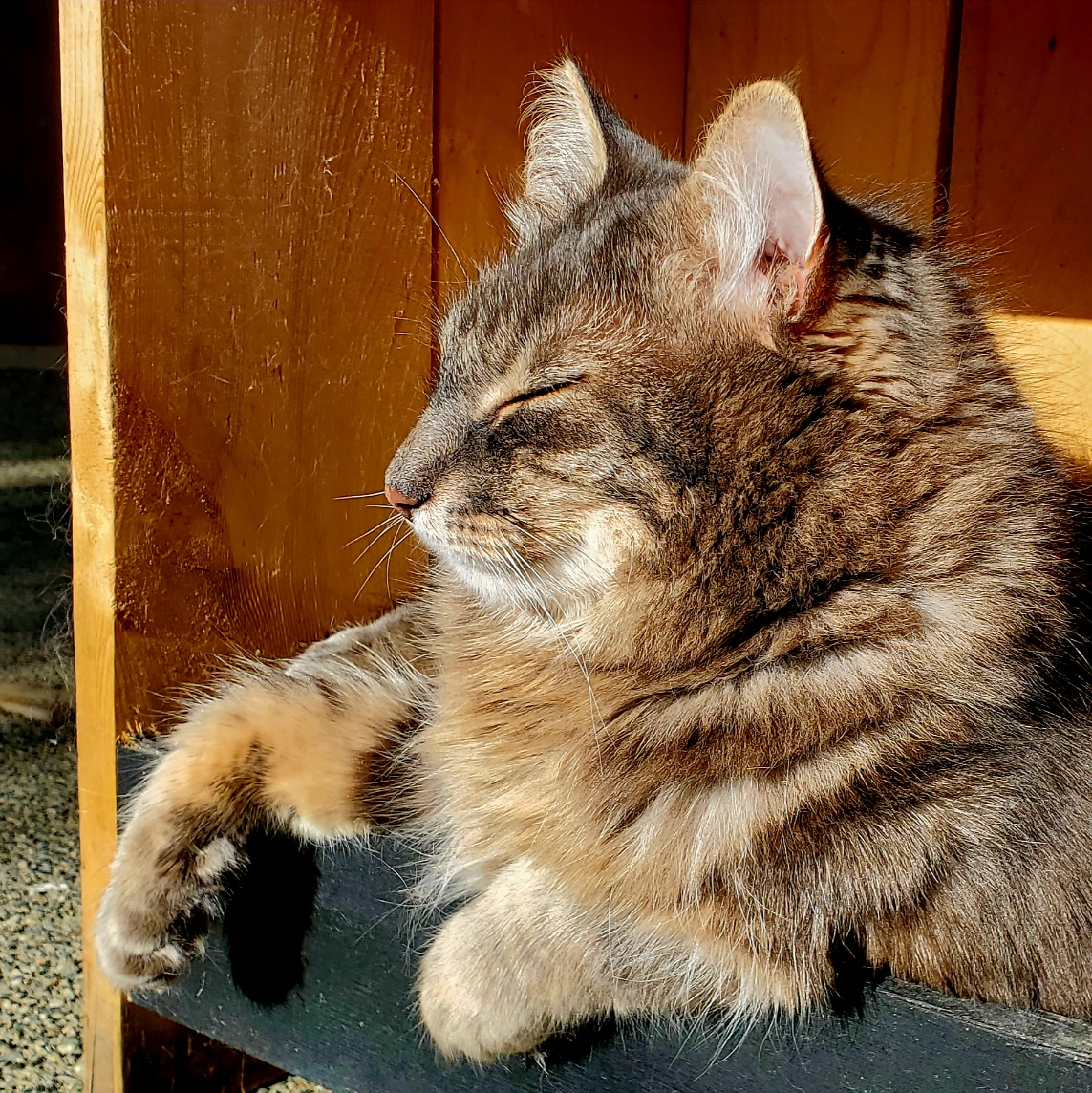
Rather than go on about things that didn’t happen and will not happen, here are the cat photos as promised in my last post:
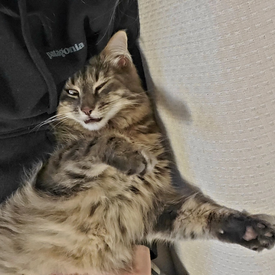
And one more:
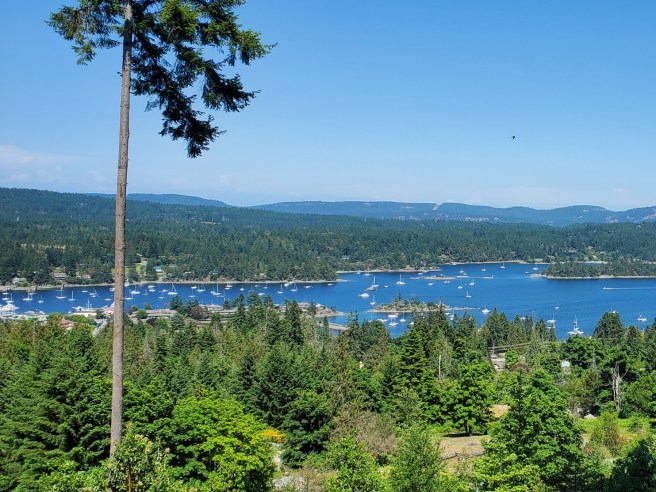
I visited Mr. Woo on Salt Spring over the last weekend of May. (Incidentally, Mr. Woo’s human, Alex, gave me the aloe vera plant a year ago.) I’d gotten a text from Alex earlier in the week asking if I could make it to Salt Spring Island from Friday until Monday to watch Mr. Woo. I typically work Saturdays, but because my original plans to visit the mainland fell through, fate had me chill with Mr. Woo and ride hills.
The Gulf Islands are hilly! Of all Gulf Islands, Salt Spring is the most accessible. It’s also the largest–by far. Several main roads are hell to ride on, some of which are unavoidable, such as Fulford Ganges. The way people drive on these roads makes me question whether Salt Springers really deserve their reputation as hippies. Many side roads don’t link up, so one eventually finds themselves back on the debris-riddled narrow shoulders of Fulford Ganges Road. For the first time, I was grateful for my Garmin Varia radar. The radar detects vehicles approaching from behind up to 200m away, which is handy when navigating winding roads full of blind curves.
I made it to Alex’s place before sunset. When I was ready to sleep, Mr. Woo followed me into bed and kissed me good night before flopping into my arm. The next day, Mr. Woo brought a gift: a dead vole. Not wanting to offend him, when he wasn’t looking, I scooped up the corpse with a dustpan and tried flinging it into the bushes. Instead, I underestimated my strength and launched it about 20m in the air, clear over the bushes and in the middle of the neighbour’s yard.
I didn’t cover much distance by bike on my first full day there. I wasted a lot of energy making the sweltering trek to the grocery store. It’s no surprise the majority of cyclists I saw on Salt Spring were on e-bikes.
At least one person chose this as their means of transportation:

That afternoon, I rode the north end loop and finished it with a 3km climb with an average grade of 8%. I started my ride trying to avoid squashing the tent caterpillars that teemed on the road, but when I hit that last climb, they were so numerous that I gave up. Tree branches were drooping from the weight of their nests. Disgusting.
While I have a paid Strava membership which lets me create routes, their app doesn’t have this feature. I used the Garmin Connect app instead. The problem was that it was impossible to link some of the roads. The global heatmap showed me more options than the Garmin Connect route mapping tool would allow.
I chose to attempt the Mt. Tuam climb on day three. Not many people appeared to make it all the way to the summit from Musgrave/Mt. Tuam road, but it seemed possible. Besides, I was intrigued by this when I checked Google Map satellite view:
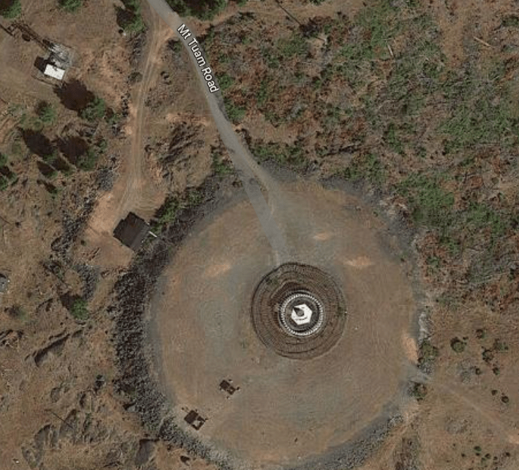
I barely made it up there, not because it was a tough 8km climb up a gravel road, but because I had to go around two gates that followed NO TRESPASSING signs. I guess the few Strava users that made it to the summit ignored those signs? This mountain is mostly inaccessible because it’s all private property. What the fuck? It’s a fucking mountain!
I valiantly ignored the signs and gates until I was confronted by a security camera. Thus, I began my careful descent: I’d only seen two vehicles on my hour-long journey up the mountain. End of day stat: 71km and 1,715m elevation gain.
I’d do it again, hopefully by the end of this summer!
(This post was going to be way more thorough, but so much time has passed since this trip that I just can’t do it.)

2 thoughts on “Wooed on Saltspring.”